



Everest Base Camp Trek Connectivity Guide 2026: Mobile, Wi-Fi & Safety Tips
 Nepal Vision Treks
 Jan 29, 2026
 23 Min Read
The Everest Base Camp trek has always had some sort of a draw, the one that catches you off guard and does not leave. That pull is even more in 2026. Perhaps it is the post-pandemic wanderlust that is still in the air, or perhaps it is just the mere, age-old promise of being eye to eye with the highest mountain in the world. One way or another, the number of trekkers flocking to Lukla, throwing on their boots, and heading into the Khumbu is perhaps more than ever a mass of excited anticipation and nervous anticipation.
It is in the midst of all this adventure that the need to remain connected has crept in. Not only to share photos or read messages, but also to keep safe, coordinate, and have a sense of peace. A working mobile phone means a speedy connection to your instructions, your trekking company, or the ambulance. It may also imply a home message after a hard climb throughout the day, or a casual picture of the sunrise, which you have sent to someone who has been cheering you up back at home.
This guide dissects what connectivity will really look like on the Everest Base Camp trek in 2026—not only mobile network connectivity and Wi-Fi access, but also the actual internet speeds and costs, and a few useful survival tips. None of that exaggeration and sugar-coating. Nothing but a good, tried and true experience, and you have just an idea of what you are going to see before you set foot on that winding mountain trail.
Mobile Network Connectivity on the EBC Trek
The first step to being connected during the Everest Base Camp trek is to choose the appropriate mobile network and SIM card. The three major Ncell, Nepal Telecom (NTC), and SmartCell telecom providers in Nepal provide services in the majority of towns and along lower trekking trails.
SIM cards can be readily found in Kathmandu and Pokhara, and can be bought at Lukla airport by those who enjoy sorting out connectivity once they get into the mountains. Rates are relatively low, averaging NPR 100-200 (approximately 1-2 USD), even though registration has not yet been completed and passport verification is mandatory under the region's telecom laws.
Ncell is the provider that works best in cities and the lower altitude areas of trekking, with speeds of 4G, which is the highest available, anywhere the company has coverage. Conversely, Nepal Telecom is more reliable in remote areas and at high altitudes, so the farther one travels up the hill and the more dispersed the settlements are, the more they prefer it over Nepal Telecom. SmartCell has limited network coverage, which is why the majority of trekkers favour Ncell and NTC, usually using the two via dual SIM cards, giving them wider route coverage.
Network Overage in The Trek.
The reliability of networks along the Everest Base Camp route is greatly influenced by altitude, terrain, weather, and settlement density. Connectivity decreases gradually with increasing elevation, making the digital experience a matter of alternating access and constraint.
Lukla to Namche Bazaar
This area has strong, stable reception from Ncell and Nepal Telecom. Voice and texting works smoothly. Basic internet use, like email, browsing and messaging, tends to be stable. This is the most reliable digital area throughout the journey, mainly because of improved infrastructure, lower altitude, and proximity to developed settlements.
Namche Bazaar to Tengboche
Connectivity is even shaky beyond Namche. Ncell signal is intermittent, with periods of access and complete signal loss. Nepal Telecom, in turn, has better signal quality, allowing for necessary communication, texting, and limited data access. The slow internet is slow, but simple digital communication is usually problem-free.
Tengboche to Dingboche / Lobuche.
Since Tengboche, Nepal Telecom has been the first network you can trust, and it runs on 2G or low-quality 3G connections. Internet speeds are significantly reduced and are mainly used for emergency messages, navigation apps, and short communications. Sending pictures, making video calls, or constantly surfing the web is impractical owing to limited bandwidth and frequent signal disruptions.
Gorak Shep / Everest Base Camp
Mobile signals become virtually weak at very high altitudes. Direct network access is very uncommon, but some lodges offer Wi-Fi powered by NTC. Even then, speed is very low and highly prone to weather and atmospheric conditions, and user overload. The severe climatic conditions in the Himalayas, with rugged terrain, deep valleys, and erratic weather, pose constant difficulties for connectivity.
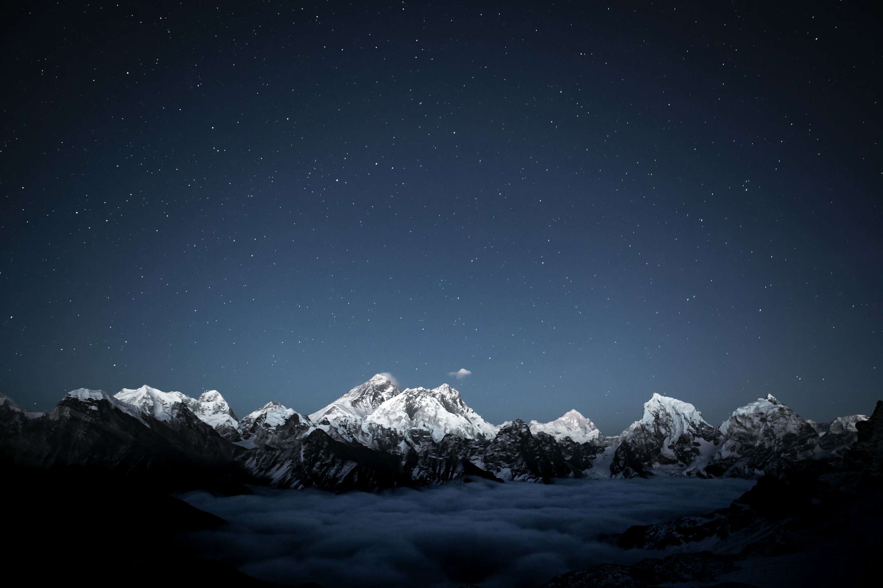
With increasing altitude, there is a gradual shift from incessant connection to digital silence. Interestingly, this waning signal tends to make people more sensitive to the senses and to distract the eyes from screens to glaciers, rock faces, and the high points of the Himalayas around.
Mobile Content Connection Advice.
There are a few strategic decisions that would make the trail very reliable in terms of connectivity.
Best SIM Options:
Ncell coverage in the lower area and NTC in the high area would be the most balanced coverage. Trekking tourists have two SIM configurations, and eSIM services are growing at Kathmandu and Pokhara airports, making it easier to set up modern devices.
Roaming vs Local SIM:
International roaming is convenient but very expensive due to the high cost and unreliable signal strength. Local SIM cards would still be the cheapest and best option, particularly for treks lasting more than a few days.
Signal Boosters and Power Control:
Signal boosters can only give modest benefits in poor signal coverage, whereas battery management is much more important. It is necessary to carry high-capacity power banks and solar chargers, as charging facilities become scarcer and more expensive with increasing altitude.
Connection of the EBC trek is a balancing act between technology and topography. With appropriate preparation, it is possible to connect without letting the devices dominate the experience.
Charging Devices
The higher the altitude, the less stable power sources are available. As a result, battery management is a key aspect of trek preparation. The low temperatures, long hiking durations, and fewer charging periods all contribute to a gradual decline in device performance.
Availability Charges at Teahouses.
- At elevations of 2,500-3,000 meters, charging is still popular, often included with accommodation or a meal.
- Charging is effective above 3,500 meters, and is generally:
- Limited to evening shifts.
- From NPR 200-500 (1.50-4), including per device.
- Daily sun-based, and therefore reliant on the availability of sunlight.
High-altitude villages may greatly reduce the likelihood of charging due to cloudy weather or snow. Other lodges go so far as not charging at all during long spells of bad weather, focusing on essential lighting and kitchen functions.
Suggested Backup Power Primer.
- Portable Power Banks: 10,000 -20,000 mAh devices give 3-5 days of average device performance.
- Solar Chargers: Can be used on longer adventures, but their power varies widely with sunlight exposure.
- Multi-Port Charging cables: Decrease reliance on scanty plugs.
- Practical hint: Starting with a minimum of two fully charged power banks will provide continuous power to the devices during a hiking trip over seven days, especially when traveling to remote and high altitude areas.
Internet Connection in the EBC Trek
The Wi-Fi connection throughout the trail to the Base Camp is prevalent yet not very fast. All teahouses and lodges, from Lukla to Gorak Shep, offer Wi-Fi, though quality and speed degrade significantly with altitude. Connection in lower towns like Namche Bazaar and Tengboche is usually sufficient for messaging, emails, and light browsing. Wi-Fi can frequently go dead and slow beyond Dingboche.
Pricing is determined by location and altitude. Wi-Fi is usually expensive in the lower parts, costing NPR 400-600 per day (3-5 USD). Gifts. Higher up, the fees may increase to NPR 1,200 ($910 USD) or more, though at lower speeds. The Wi-Fi networks are mostly shared among guests, causing congestion during the evening hours. Privatized Wi-Fi connections are uncommon and very expensive.
Such less-speedy connections inherently level expectations, promoting light usage, such as brief messages, brief photo posts, and necessary communication, over longer browsing or media usage.
Expectations of Internet Speed.
The frustration can be avoided by realistic speed expectations. At Lukla and Namche Bazaar, the speed is usually 1-5 Mbps, which is enough to send messages and emails, and to make video calls rarely. North of Dingboche, internet connectivity is often below 1 Mbps, so streaming, uploading videos, and working remotely are not feasible.
Higher-ups make it impossible to perform large uploads and livestreaming. Rather, short messaging, sharing of low-resolution photos, and simple email are the surest applications. This technological lag may itself seem like a natural accompaniment of this journey, a natural rhythm which corresponds to the speed of travel in the highlands.
Internet Available Hotspots / Satellites.
Satellite phones and portable Wi-Fi hotspots would be reliable backups if connectivity is needed. The most common applications of these devices include emergency communication, expedition logistics, research, and professional media uploading.
In Kathmandu, the cost of satellite phone rental ranges from 7 to 15 USD per day, without airtime. The price of portable satellite hotspots fluctuates between NPR 1,000-1,500/day (8-12 USD). Internet connections range from 256 kbps to 2 Mb, with a focus on reliability rather than speed.
These gadgets can be considered highly vital safety equipment in remote areas, where emergency communications are guaranteed even in the event of cellular and lodge-based network failures.
Staying Connected Safely
Convenience is not the only way to describe reliable communication in the Himalayas. In remote, high-altitude areas such as the Everest region, connectivity usually remains a silent layer of protection. It runs in the background but plays a critical role when things start going awry. In emergency management and weather advisories, from route selection and physical condition tracking to connectivity planning, considerate planning can greatly minimize risk while offering a hint of reassurance during periods of long travel time.
In these areas, where the weather can shift suddenly and the landscape can redefine a strategy in a few minutes, the availability of reliable communication technology can be less of an extravagance and more of a silent need.
Emergency Communication
Nepal has a countrywide emergency service system that operates wherever mobile networks are available. The following numbers are the main points of contact in case of urgent situations:
- Police: 100
- Ambulance: 102
- Fire Brigade: 101
- Tourist Police (Kathmandu): +977-1-4247041
In large trekking zones like Everest, Annapurna, Langtang, and Manaslu, organizing a rescue operation is usually a stratified process that involves licensed trekking companies, local guides, lodge proprietors, and helicopter evacuation service providers.
Communication speed in medical emergencies is essential, especially in situations involving acute altitude sickness, physical trauma, or severe weather exposure. The best path to rescue operations is through satellite phones and Wi-Fi calling using lodge facilities, particularly in areas with poor mobile signal.
Helicopter evacuations are normally arranged through trekking agencies, insurance firms, and individual aviation services and require precise location information, medical condition, and weather clearance. At these times, effective communication tools tend to be the difference between responding quickly and delay.
Weather Problems and Altitude that impact Signal Reliability.
The Himalayas and atmospheric conditions are critical factors affecting signal reliability in the region. Beyond 3,500-4,000 feet, mobile signals become significantly weak, especially in tight valleys, sharp gorges, and rough mountain roads.
Connection is also complicated by the weather:
- Heavy snowfalls and cloud cover interrupt microwave relay stations.
- Storms and high winds disrupt tower and satellite relay connections.
- Low temperatures reduce the battery's efficiency, shortening its lifespan.
Signals are still strongest in settled areas like Lukla, Namche Bazaar, Dingboche, Manang, Jomsom, and Ghorepani, where infrastructure is more dense. Outside these hubs, most villages have poor or no signal, especially along the trail's remote sections.
Another silent challenge is network congestion during the peak trekking seasons, namely spring (March - May) and autumn (September - November). The large flow of trekkers on a single bandwidth can easily cause slow speeds and unreliable connections, even where coverage is in theory available.
No method of communication should be trusted. A combination of local SIM data, lodge Wi-Fi facilities, offline navigation apps, satellite backup services, and emergency contact planning will create a safety net capable of operating under a variety of circumstances.
Safety Applications and Offline Solutions.
In mountain trekking conditions, offline operations are often considered more useful than real-time communication. As soon as the signal goes dead, which it frequently does, pre-downloaded maps, navigation applications, and safety information silently replace them, providing direction, navigation, and comforting information.
Recommended Offline Apps
- Maps.me: Street view maps, hiking trail maps, village positions, hillsides, and routes.
- AllTrails: Newest hiking pathways, trail environments, client comments, elevation charts, and waypoints.
- Gaia GPS: Useful navigation, topographic overlay, GPX route, and satellite imagery.
- Google Maps Offline: Stores maps, map lodge locations, emergency points, and map navigation information in the area.
- What3Words: Super accuracy in emergency location sharing with GPS, where there is a lack of mapping facilities.
Emergency Apps & Communication.
- WhatsApp: Uses low-bandwidth messaging and calling, which works even with weak signals and low-speed Wi-Fi.
- Garmin Messenger / ZOLEO App: Satellite-based messaging providers that are used to communicate during emergency situations in locations that are not covered by cellular services.
- Life360: Sharing location, emergency alerts and group tracking between trekking partners.
Pre-Downloading Essential Data Tips.
- Keep a whole trekking territory on board during the time you are in communication with powerful Wi-Fi networks in Kathmandu or Pokhara.
- Plan routes, altitude profiles, and trail junctions as saved routes to use when offline.
- Locations of store lodges, health posts, and evacuation landing points to be used in the case of an emergency.
- Download offline language packs, emergency phrases, and simple medical guides.
- Always have trekking permits, insurance papers, emergency contacts, and passport numbers readily available as screenshots.
Such preparations silently eliminate unnecessary pressure as the network goes down. The trekkers, in effect, navigate with confidence even when the network is offline.

Cost Breakdown for Connectivity
Although Nepal is quite remote, the cost of connectivity there has been exceptionally low, particularly compared to trekking destinations in Europe, North America, or Central Asia.
SIM Cards
Ncell SIM Cards or Nepal Telecom SIM Cards:
- SIM price: NPR 100–200 ($0.75–$1.50)
Available easily at Kathmandu Airport, Pokhara Airport, and centers in the city that provide services.
Popular Trekking Data Plan:
NPR 1,499 (~$11 USD)
→ 100GB high-speed data
→ Unlimited night data
→ Voice calls + SMS
→ Excellent coverage on the entire route of Everest Base Camp, Gorakshep, and Kala Patthar.
Data Packages
Typical Options:
- Daily packs: NPR 50–150 ($0.40–$1.15)
- Weekly packs: NPR 300–800 ($2.50–$6)
- Monthly packs: NPR 799–1,499 ($6–$11)
Data Limits:
Depending on the package chosen, 5GB-100GB.
- Best Value: High-data packs are offered monthly at better prices than low-data packs. In case of long hikes, there is a need to share photos frequently and use an app that requires a lot of data.
- Wi-Fi at Lodges: Wi-Fi networks are mostly available along trekking paths in the Everest Link and Nepal Wireless Networking Project.
Typical Pricing:
- NPR 300–500 ($2–$4) → 24 hours, limited data
- NPR 1,000 ($7.50) → 10GB data, valid for 24 hours
Speed is reduced exponentially beyond 4,000 meters, and even more so during peak trekking periods, when bandwidth is exhausted by high user traffic.
Elective Satellite or Hotspot Rental Fees.
In cases of very remote expeditions like Kanchenjunga, Upper Dolpo, Dhauligiri Circuit, and winter expeditions, satellite-based communication is imperative.
Satellite Phone Rental
- $8–$15 per day
- Separately billed call charges.
Satellite Hotspots (Garmin, InReach, Thuraya)
- $10–$20 per day rental
- Monthly subscription fees range from $35 to $75, based on the number of posts.
Recommended For:
The solo traveler, winter mountaineering, high-altitude mountaineering, research teams, and remote circuit travelers with little or no cellular coverage.
To wrap up, by the time you reach the higher stretches of the Everest Base Camp trail, something subtle tends to shift. The noise of everyday life fades, the mountains start to feel impossibly close, and even a single message sent home carries a strange weight. Connectivity, in this context, becomes more than a convenience. It turns into reassurance, safety, and a quiet link to the world you’ve temporarily stepped away from.
Ready to turn your Everest Base Camp dream into a real, unforgettable journey?
Book your Everest Base Camp trek with Nepal Vision Treks today and experience the Himalayas with confidence.
FAQs
How reliable is mobile network coverage on the Everest Base Camp trek?
Which SIM card works best for the Everest Base Camp trek?
Is Wi-Fi available on the Everest Base Camp trail?
How much does Wi-Fi cost during the trek?
Can emergency services be contacted from the Everest region?
What are the best safety apps for the Everest Base Camp trek?
How can devices be charged during the trek?
Are power banks allowed on domestic flights to Lukla?
Is satellite communication necessary for the Everest Base Camp trek?
How much should be budgeted for connectivity during the trek?
Can Nepal Vision Treks assist with connectivity planning?